
Wandern rund um Schramberg. Hiking around Schramberg
Sehenswürdigkeiten, Wanderungen
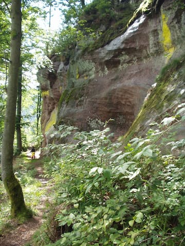
Wanderungen rund um Schramberg. 8 Touren für Dich, die Du unbedingt nachwandern solltest.
Hikes around Schramberg. 8 hiking tours for you to try.
DEUTSCH
Schöne Wandertouren:
Es freut mich immer, wenn ich Gästen ein paar gute Tipps geben kann, wie sie die nahe Umgebung bestmöglich erkunden können. Hiermit möchte ich Dir dazu einige Anregungen geben.
Wenn Du Freude an schönen Wanderrouten rund um Schramberg hast, dann werde ich Dir folgende Tipps geben:
Ruf im Browser die nachfolgenden Links/Adressen auf und schaue Dir die Routen an.
Wenn Du die Routen nachgehen möchtest, dann melde Dich bei Komoot an. Dies soll keine ! Werbung sein. Es gibt viele gute Wanderapps. Aber damit wurden die Routen generiert. Deine erste Karte /Region kannst Du nach der Anmeldung frei nutzen. Die kannst Du z.B. für´s Joggen, Wandern, Bergwandern etc. verwenden und Routen planen oder bestehende nachvollziehen. Alles Weitere kannst Du auf der Site www.komoot.de erfahren.
Lade Dir dazu auch die Android oder iOS APP von Komoot für Dein Handy herunter.
Ich habe jedenfalls eine Menge Spaß auf der Wanderung gehabt und wünsche Dir dies ebenfalls. Vergiss Deine Wanderschuhe nicht. Du wirst Sie brauchen!!
*******************************************************************
ENGLISH
Beautiful hiking tours:
It always pleases me to be able to give guests some good tips on how to best explore the surrounding area.
If you enjoy beautiful hiking trails around Schramberg, then I will give you the following suggestions:
Call the following links/addresses in the browser and look at the routes.
If you want to follow the routes, then log in to "Komoot". This should not ! be advertising. There are many good hiking apps. But with that the following routes were generated. You can freely use your first map / region after registering. Great for jogging, hiking, mountain hiking etc. to use and plan routes or repeat existing hiking. Everything else you can learn on the site.
Download the Android or iOS Komoot APP for your phone.
Anyway, I had a lot of fun on the hike and I wish you that too. Don't forget your hiking boots. You'll need them!!
7 helybéli ajánlásával
Schramberg
DEUTSCH
Schöne Wandertouren:
Es freut mich immer, wenn ich Gästen ein paar gute Tipps geben kann, wie sie die nahe Umgebung bestmöglich erkunden können. Hiermit möchte ich Dir dazu einige Anregungen geben.
Wenn Du Freude an schönen Wanderrouten rund um Schramberg hast, dann werde ich Dir folgende Tipps geben:
Ruf im Browser die nachfolgenden Links/Adressen auf und schaue Dir die Routen an.
Wenn Du die Routen nachgehen möchtest, dann melde Dich bei Komoot an. Dies soll keine ! Werbung sein. Es gibt viele gute Wanderapps. Aber damit wurden die Routen generiert. Deine erste Karte /Region kannst Du nach der Anmeldung frei nutzen. Die kannst Du z.B. für´s Joggen, Wandern, Bergwandern etc. verwenden und Routen planen oder bestehende nachvollziehen. Alles Weitere kannst Du auf der Site www.komoot.de erfahren.
Lade Dir dazu auch die Android oder iOS APP von Komoot für Dein Handy herunter.
Ich habe jedenfalls eine Menge Spaß auf der Wanderung gehabt und wünsche Dir dies ebenfalls. Vergiss Deine Wanderschuhe nicht. Du wirst Sie brauchen!!
*******************************************************************
ENGLISH
Beautiful hiking tours:
It always pleases me to be able to give guests some good tips on how to best explore the surrounding area.
If you enjoy beautiful hiking trails around Schramberg, then I will give you the following suggestions:
Call the following links/addresses in the browser and look at the routes.
If you want to follow the routes, then log in to "Komoot". This should not ! be advertising. There are many good hiking apps. But with that the following routes were generated. You can freely use your first map / region after registering. Great for jogging, hiking, mountain hiking etc. to use and plan routes or repeat existing hiking. Everything else you can learn on the site.
Download the Android or iOS Komoot APP for your phone.
Anyway, I had a lot of fun on the hike and I wish you that too. Don't forget your hiking boots. You'll need them!!
Várossal kapcsolatos tanácsok
Kihagyhatatlan
Ruine Hohenschramberg – Burg Falkenstein Runde
1. Tour
https://www.komoot.de/smarttour/562375?ref=atd
Schwere Wanderung. Gute Grundkondition erforderlich. Gute Trittsicherheit, festes Schuhwerk und alpine Erfahrung notwendig.
1st tour
Ruin Hohenschramberg - Castle Falkenstein round
https://www.komoot.de/smarttour/562375?ref=atd
Heavy hike. Good basic condition required. Good sure-footedness, sturdy footwear and alpine experience necessary.
Dauer / Duration Std./Min. ± 04:05
Strecke / distance 11,8 km
Geschwindigkeit / Speed ± 2,9 km/h
Aufstieg / Ascent 580 m
Abstieg / Descent 570 m
Kihagyhatatlan
Burgruine Berneck – Heuwegle Runde von Schramberg
2. Tour
https://www.komoot.de/smarttour/292142?ref=atd
Mittelschwere Wanderung. Gute Grundkondition erforderlich. Überwiegend gut begehbare Wege. Trittsicherheit erforderlich.
2nd tour
https://www.komoot.de/smarttour/292142?ref=atd
Medium difficult hike. Good basic condition required. Mostly well walkable paths. Surefootedness required.
Dauer / Duration Std./Min. ± 02:10
Strecke / distance 6,65 km
Geschwindigkeit / Speed ± 3,3 km/h
Aufstieg / Ascent 190 m
Abstieg / Descent 190 m
Kihagyhatatlan
Burgstüble – Ruine Hohenschramberg Runde von Lauterbach
3. Tour
https://www.komoot.de/smarttour/245571?ref=atd
Mittelschwere Wanderung. Gute Grundkondition erforderlich. erforderlich.Überwiegend gut begehbare Wege. Trittsicherheit
3rd tour
https://www.komoot.de/smarttour/245571?ref=atd
Medium difficult hike. Good basic condition required. Mostly well walkable paths. Surefootedness required.
Dauer / Duration Std./Min. ± 02:44
Strecke / distance 9,20 km
Geschwindigkeit / Speed ± 3,3 km/h
Aufstieg / Ascent 300 m
Abstieg / Descent 300 m
Kihagyhatatlan
Kapfhäusle-Gedächtnishaus Fohrenbühl, Runde von Lauterbach
4. Tour
https://www.komoot.de/smarttour/145855?ref=atd
Mittelschwere Wanderung. Gute Grundkondition erforderlich. Leicht begehbare Wege. Kein besonderes Können erforderlich.
4th tour
https://www.komoot.de/smarttour/145855?ref=atd
Medium difficult hike. Good basic condition required. Easily walkable paths. No special skills required.
Dauer / Duration Std./Min. ± 03:11
Strecke / distance 11,20 km
Geschwindigkeit / Speed ± 3,5 km/h
Aufstieg / Ascent 270 m
Abstieg / Descent 270 m
Kihagyhatatlan
Heuwegle – Burgruine Berneck Runde von Raustein
5. Tour
https://www.komoot.de/smarttour/162085?ref=atd
Mittelschwere Wanderung. Gute Grundkondition erforderlich. Überwiegend gut begehbare Wege. Trittsicherheit erforderlich.
5th tour
https://www.komoot.de/smarttour/162085?ref=atd
Medium difficult hike. Good basic condition required. Mostly well walkable paths. Surefootedness required.
Dauer / Duration Std./Min. ± 04:26
Strecke / distance 13,00 km
Geschwindigkeit / Speed ± 2,9 km/h
Aufstieg / Ascent 580 m
Abstieg / Descent 580 m
Kihagyhatatlan
Burgen um Schramberg,Tagestouren im mittleren Schwarzwald
6. Tour
https://www.komoot.com/tour/54400596?ref=wtd
Schwere Wanderung. Sehr gute Kondition erforderlich. Überwiegend gut begehbare Wege. Trittsicherheit erforderlich.
6th tour
https://www.komoot.com/tour/54400596?ref=wtd
Heavy hike. Very good condition required. Mostly well walkable paths. Surefootedness required.
Dauer / Duration Std./Min. ± 07:45
Strecke / distance 24,10 km
Geschwindigkeit / Speed ± 3,1 km/h
Aufstieg / Ascent 980 m
Abstieg / Descent 970 m
Kihagyhatatlan
Burgruine Hohenschramberg nach Burgruine Ober-Falkenstein
7. Tour
https://www.komoot.de/tour/198740177
Mittelschwere Wanderung. Sehr gute Kondition erforderlich. Überwiegend gut begehbare Wege. Trittsicherheit erforderlich.
7th tour
https://www.komoot.de/tour/198740177
Tough hike. Good physical condition required. Predominantly well passable paths. Sure-footedness required.
Dauer / Duration Std./Min. ± 01:11
Strecke / distance 3,72 km
Geschwindigkeit / Speed ± 3,2 km/h
Aufstieg / Ascent 110 m
Abstieg / Descent 200 m
Kihagyhatatlan
Runde vom Burgweg 66, Schramberg zur Ruine Burg Schilteck
8. Tour
https://www.komoot.de/tour/198740177
Leichte Wanderung. Für alle Fitnesslevel. Überwiegend gut begehbare Wege. Trittsicherheit erforderlich.
8th tour
https://www.komoot.de/tour/198740177
Easy hike. For all fitness levels. Mainly well passable paths. Sure-footedness required.
Dauer / Duration Std./Min. ± 56:00
Strecke / distance 3,25 km
Geschwindigkeit / Speed ± 3,5 km/h
Aufstieg / Ascent 80 m
Abstieg / Descent 80 m