
Guidebook for Beverly Hills
Sightseeing
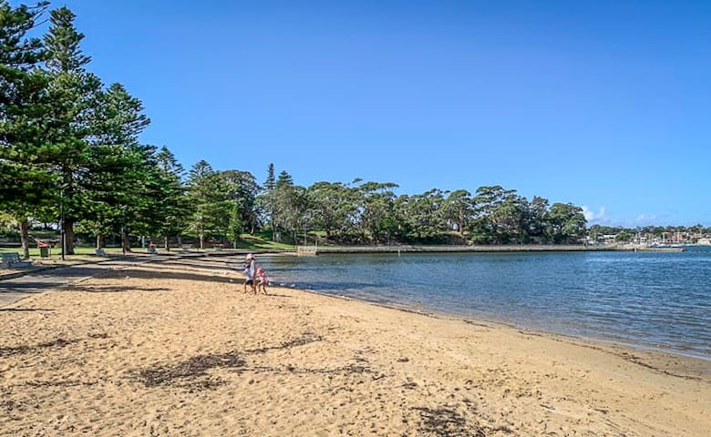
CARSS PARK: PLAYGROUND, BEACH, SWIMMING, BUSH WALKS + GREAT CAFE!
Carss Bush Park is a magnificent place to spend a day with the family. Carss Park scores the family friendly trifecta having a wonderful playground; a terrific cafe/restaurant, the Carss Park Cafe and Grill, right beside the playground, with delightful views over the water; a beach and enclosed swimming area on the Georges River; and plenty of space to picnic and play, plus some small bush walks good for all ages of the family.
Carss Park is a large park with a big playground, a separate BBQ area, lots of picnic tables and shelters and a sheltered swimming beach on a bay with shark nets. There is also a bike path nearby, although you are not allowed to ride bikes in playing/swimming/picnic area of Carss Park. There are lots of grass areas to spread out picnic rugs and have a sit down.
The playground area is surrounded by trees so various parts of the playground are in shade at various times depending on the day and season.
The playground has three different sets of equipment plus two "baby" swings, two "bigger kid" swings and a couple of rocking springs sitting on animals. One of the playground areas is small with easy steps and a small slide for littles. Another area has an easy-to-climb ramp with side-by-side small slides plus a bigger enclosed slide at one end and a few tunnels and bridges to walk across. The third set has two high, bumpy slides, a climbing rope and a long pole to slide down catering to older kids. In the middle of the three sets of equipment is a kind of raised boardwalk that the kids can run up and down and parents can sit on to watch kids from all areas (although it's not shaded so not so pleasant to sit on in summer - great in winter).
The playground area is not fenced and there is a beach within the park, but it is about 75-100m away from the play equipment.
The beach is on the George's River with no waves, and great for littles to play in the water. Sand can be a bit covered in seaweed and sticks/dirt etc if there's been rough weather recently etc.
There are about a dozen gas BBQs in a BBQ area that is about 50-75m from the playground area.
There are picnic tables and about 5-6 larger picnic shelters dotted across the park.
Within the park is also the historic Carss Park Cottage, built by William Carss in the 1860's. You can stroll around the outside of it at any time or visit the museum inside it on Sunday and Public Holiday afternoons 1-5pm.
On the outskirts of the park is a bike track that is about 400m long. From it, you can also join the 500m bike circuit of Todd Park which is adjacent to Carss Park.
Carss Park is a very popular park at weekends and especially so in summer.
Carrs Bush Park
CARSS PARK: PLAYGROUND, BEACH, SWIMMING, BUSH WALKS + GREAT CAFE!
Carss Bush Park is a magnificent place to spend a day with the family. Carss Park scores the family friendly trifecta having a wonderful playground; a terrific cafe/restaurant, the Carss Park Cafe and Grill, right beside the playground, with delightful views over the water; a beach and enclosed swimming area on the Georges River; and plenty of space to picnic and play, plus some small bush walks good for all ages of the family.
Carss Park is a large park with a big playground, a separate BBQ area, lots of picnic tables and shelters and a sheltered swimming beach on a bay with shark nets. There is also a bike path nearby, although you are not allowed to ride bikes in playing/swimming/picnic area of Carss Park. There are lots of grass areas to spread out picnic rugs and have a sit down.
The playground area is surrounded by trees so various parts of the playground are in shade at various times depending on the day and season.
The playground has three different sets of equipment plus two "baby" swings, two "bigger kid" swings and a couple of rocking springs sitting on animals. One of the playground areas is small with easy steps and a small slide for littles. Another area has an easy-to-climb ramp with side-by-side small slides plus a bigger enclosed slide at one end and a few tunnels and bridges to walk across. The third set has two high, bumpy slides, a climbing rope and a long pole to slide down catering to older kids. In the middle of the three sets of equipment is a kind of raised boardwalk that the kids can run up and down and parents can sit on to watch kids from all areas (although it's not shaded so not so pleasant to sit on in summer - great in winter).
The playground area is not fenced and there is a beach within the park, but it is about 75-100m away from the play equipment.
The beach is on the George's River with no waves, and great for littles to play in the water. Sand can be a bit covered in seaweed and sticks/dirt etc if there's been rough weather recently etc.
There are about a dozen gas BBQs in a BBQ area that is about 50-75m from the playground area.
There are picnic tables and about 5-6 larger picnic shelters dotted across the park.
Within the park is also the historic Carss Park Cottage, built by William Carss in the 1860's. You can stroll around the outside of it at any time or visit the museum inside it on Sunday and Public Holiday afternoons 1-5pm.
On the outskirts of the park is a bike track that is about 400m long. From it, you can also join the 500m bike circuit of Todd Park which is adjacent to Carss Park.
Carss Park is a very popular park at weekends and especially so in summer.
Oatley Park is one Sydney’s finest areas of natural bush land. Bounded by the Georges River, Lime Kiln Bay, and Jew Fish Bay, it covers 45 hectares.
The park is a popular place for picnics, recreational and sporting activities, including an oval. It has a fabulous playground, a “castle” and netted swimming baths.
Also, Oatley Park offers a 2km cycling loop, several walking tracks and a wheel-chair accessible section from Myra Wall car park.
Oatley park
Oatley Park is one Sydney’s finest areas of natural bush land. Bounded by the Georges River, Lime Kiln Bay, and Jew Fish Bay, it covers 45 hectares.
The park is a popular place for picnics, recreational and sporting activities, including an oval. It has a fabulous playground, a “castle” and netted swimming baths.
Also, Oatley Park offers a 2km cycling loop, several walking tracks and a wheel-chair accessible section from Myra Wall car park.
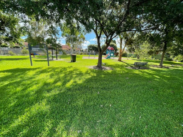
Like many other cities, Sydney is famous for its peaceful green areas. Gloucester Reserve offers you a means to relax for a while and unwind. Smell flowers, sunbathe, walk with your pets, admire the greenery, meditate, meet people or participate in celebrations in your free time.
Gloucester Reserve (rating 5 of local community website https://nicelocal.com.au/sydney/entertainment/gloucester_reserve/) is located at Australia, Beverly Hills NSW 2209, 179 Gloucester Rd and just opposite our home.
Gloucester Reserve
179 Gloucester RoadLike many other cities, Sydney is famous for its peaceful green areas. Gloucester Reserve offers you a means to relax for a while and unwind. Smell flowers, sunbathe, walk with your pets, admire the greenery, meditate, meet people or participate in celebrations in your free time.
Gloucester Reserve (rating 5 of local community website https://nicelocal.com.au/sydney/entertainment/gloucester_reserve/) is located at Australia, Beverly Hills NSW 2209, 179 Gloucester Rd and just opposite our home.
Rock climbing @ Bald Face Point
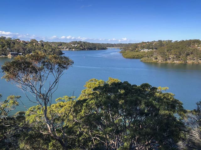
A bushland reserve, named when sandstone was quarried from the point at the end of Stuart Street for the construction of Tom Ugly's Bridge, leaving a bare cliff face. Bald Face Point is bounded on three sides by waterways and bays off the Georges River which flows into Botany Bay. The park feature a lookout on the high ground of the point. A path leads down the hillside to the quarry that gave the point its name, then to a small sandy beach with views to Tom Uglys Bridge. Aboriginal rock art and axe grinding grooves have been recorded here, but erosion of the soft sandstone of this rock point has rendered them difficult to see, not to mention more recent engravings by all and sundry on the same rock faces.
Close to the water's edge is a rock overhang where there are visible signs of its occupation by the local Aborigines of pre-colonial times. There is a shell midden nearby, and the cave itself is blackened by hundreds of years of fires used to cook the fish and oysters on which they would feed.
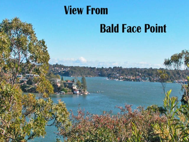
Bald Face Point
Rock climbing @ Bald Face Point
A bushland reserve, named when sandstone was quarried from the point at the end of Stuart Street for the construction of Tom Ugly's Bridge, leaving a bare cliff face. Bald Face Point is bounded on three sides by waterways and bays off the Georges River which flows into Botany Bay. The park feature a lookout on the high ground of the point. A path leads down the hillside to the quarry that gave the point its name, then to a small sandy beach with views to Tom Uglys Bridge. Aboriginal rock art and axe grinding grooves have been recorded here, but erosion of the soft sandstone of this rock point has rendered them difficult to see, not to mention more recent engravings by all and sundry on the same rock faces.
Close to the water's edge is a rock overhang where there are visible signs of its occupation by the local Aborigines of pre-colonial times. There is a shell midden nearby, and the cave itself is blackened by hundreds of years of fires used to cook the fish and oysters on which they would feed.
Sydney Királyi Botanikus Kert
Mrs Macquaries RoadTowra Point Nature Reserve
Captain Cook DriveBeverly Hills Park
Doyle Gardens
Penshurst Park
Royal National Park
Shopping
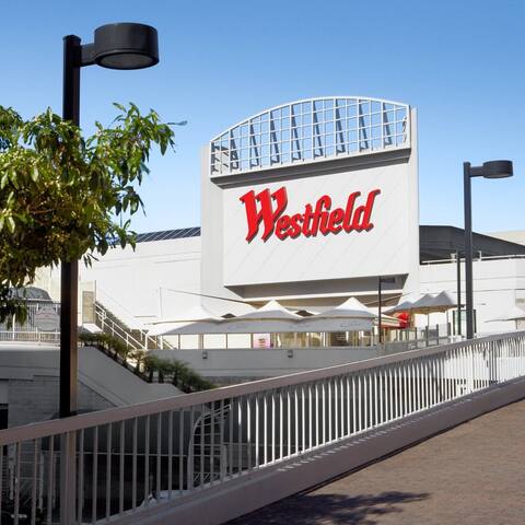
Westfield Hurstville is a shopping centre in the suburb of Hurstville in the St George area of Sydney.
Westfield Hurstville is your favourite shopping destination for fashion, beauty, lifestyle and fresh produce in Sydney's South. With an eclectic range of clothing, beauty, electronics, sports and fitness and homeware stores, alongside fresh foods from Australia's leading grocers, there is something for every shopper at Westfield Hurstville.
Westfield Hurstville has 61,231m² of floor space. 5-level mall with a wide range of stores, including 3 supermarkets, plus a cinema & casual dining. The major retailers include Big W, Kmart, Aldi, Coles, Woolworths, Cotton On, TK Maxx, Uniqlo, JB Hi-Fi, Rebel and Event Cinemas.
Westfield Hurstville, Forest Rd station
Westfield Hurstville is a shopping centre in the suburb of Hurstville in the St George area of Sydney.
Westfield Hurstville is your favourite shopping destination for fashion, beauty, lifestyle and fresh produce in Sydney's South. With an eclectic range of clothing, beauty, electronics, sports and fitness and homeware stores, alongside fresh foods from Australia's leading grocers, there is something for every shopper at Westfield Hurstville.
Westfield Hurstville has 61,231m² of floor space. 5-level mall with a wide range of stores, including 3 supermarkets, plus a cinema & casual dining. The major retailers include Big W, Kmart, Aldi, Coles, Woolworths, Cotton On, TK Maxx, Uniqlo, JB Hi-Fi, Rebel and Event Cinemas.
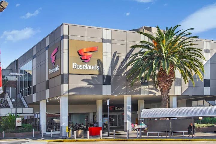
Roselands Shopping Centre is a shopping centre located out in Roselands; a beautiful suburb in south-west Sydney. Formerly known as Centro Roselands, the centre was first opened back in 1965.
At the time, it was among the largest shopping centres, but today, it has been overshadowed by the large malls of the area – but still retains its charm and is a favourite among locals. It has since undergone several renovations to maintain its structural integrity and to modernise the centre.
Roselands Shopping Centre combines the best of variety with convenience, making it a one-stop shopping destination. Ranging from restaurants to fashion stores, jewellery, homewares and entertainment, there is something for everyone to enjoy.
Treat your palate to the varied cuisine from the restaurants at the centre. Start with coffee from Gloria Jean’s or get your caffeine fix from Jamaica Blue. Muffin Break is a great place for a sweet treat, and The Cake Palace does not disappoint visitors with a sweet tooth.
Head out to Akira Sushi and enjoy some great Japanese food, or sample authentic Asian foods at Hokka Hokka. For those who love meat, the Grill On Roselands is your best bet. Kebabs are also available at Toros Kebab, as well as Gloria’s Kebabs.
Get your fashion fix from Target if you are looking for a place with different options for the family, or step out and get the best shoes from Sneakers. Treat the kids to great pieces from Smartkids and Kidz Biz; the premier shopping store for children. Other options available include Myer, Best & Less, as well as Sox Zone.
For the ladies, some of the options available include Bras N Things, Chantelle Lacy, Forever 21 and Fresh Soul, for on-trend fashion. The men aren’t forgotten either, as yd and Jeanswest stock great men’s styles.
Roselands Shopping Centre is located off King George’s Road and can easily be accessed using Canterbury Road, as well as the M5 Motorway.
Roselands Shopping Centre, Roseland Ave, Stand C
Roselands Shopping Centre is a shopping centre located out in Roselands; a beautiful suburb in south-west Sydney. Formerly known as Centro Roselands, the centre was first opened back in 1965.
At the time, it was among the largest shopping centres, but today, it has been overshadowed by the large malls of the area – but still retains its charm and is a favourite among locals. It has since undergone several renovations to maintain its structural integrity and to modernise the centre.
Roselands Shopping Centre combines the best of variety with convenience, making it a one-stop shopping destination. Ranging from restaurants to fashion stores, jewellery, homewares and entertainment, there is something for everyone to enjoy.
Treat your palate to the varied cuisine from the restaurants at the centre. Start with coffee from Gloria Jean’s or get your caffeine fix from Jamaica Blue. Muffin Break is a great place for a sweet treat, and The Cake Palace does not disappoint visitors with a sweet tooth.
Head out to Akira Sushi and enjoy some great Japanese food, or sample authentic Asian foods at Hokka Hokka. For those who love meat, the Grill On Roselands is your best bet. Kebabs are also available at Toros Kebab, as well as Gloria’s Kebabs.
Get your fashion fix from Target if you are looking for a place with different options for the family, or step out and get the best shoes from Sneakers. Treat the kids to great pieces from Smartkids and Kidz Biz; the premier shopping store for children. Other options available include Myer, Best & Less, as well as Sox Zone.
For the ladies, some of the options available include Bras N Things, Chantelle Lacy, Forever 21 and Fresh Soul, for on-trend fashion. The men aren’t forgotten either, as yd and Jeanswest stock great men’s styles.
Roselands Shopping Centre is located off King George’s Road and can easily be accessed using Canterbury Road, as well as the M5 Motorway.
Sports
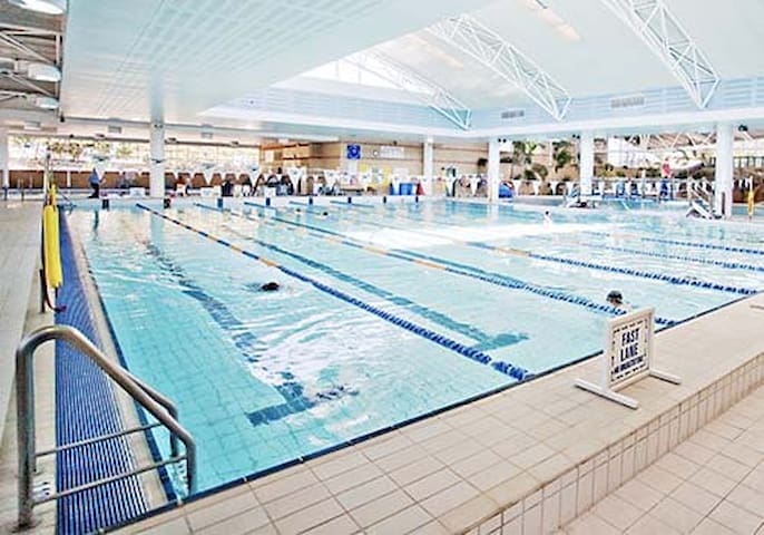
From Hurstville Aquatic Leisure Centre
"The Hurstville Aquatic & Leisure centre comes with a wide range of facilities, programs and services. We have aquatics, sauna, steam room & spa, BlueFit health club, Johnny Warren stadium, cafe, creche facilities, swimming lessons, personal & group fitness training and kids programs."
Hurstville Aquatic Leisure Centre
Forest RoadFrom Hurstville Aquatic Leisure Centre
"The Hurstville Aquatic & Leisure centre comes with a wide range of facilities, programs and services. We have aquatics, sauna, steam room & spa, BlueFit health club, Johnny Warren stadium, cafe, creche facilities, swimming lessons, personal & group fitness training and kids programs."
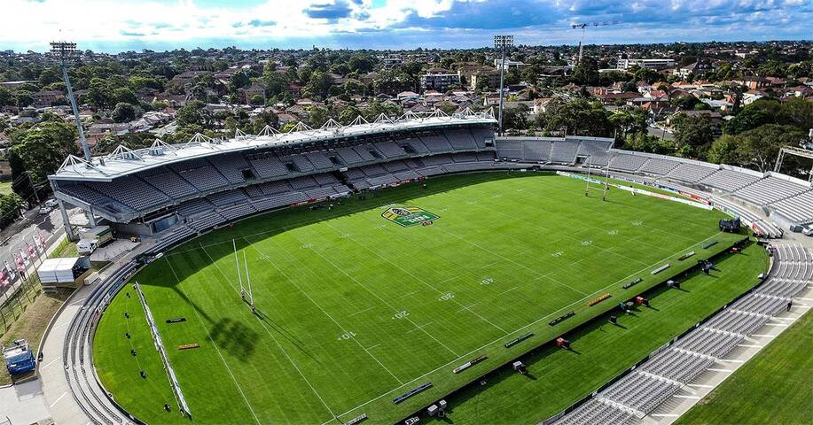
Netstrata Jubilee Stadium is the premium sporting venue in the Georges River Local Government Area, with a capacity for 20,000 people including 2,000 corporate seats, four separate dressing rooms and three function rooms ranging in capacity from 100-300 pax.
Netstrata Jubilee Stadium
Netstrata Jubilee Stadium is the premium sporting venue in the Georges River Local Government Area, with a capacity for 20,000 people including 2,000 corporate seats, four separate dressing rooms and three function rooms ranging in capacity from 100-300 pax.
Accor Stadium, known non-commercially as Stadium Australia, is an 82,500-capacity stadium located at Sydney Olympic Park in the west of Sydney, Australia. Built to be the centrepiece of the Sydney 2000 Olympic Games, it now serves primarily as a rectangular sports and entertainment venue. No other outdoor stadium used for the Olympics had been bigger than Stadium Australia at the time of the games, with its 110,000 seating capacity.
Specially designed for the unique Australian environment, the stadium shades and protects the majority of spectators. Suspended from a huge arch structure and three hectares in area, the roof is constructed from translucent polycarbonate to minimise the shadows and patches of direct sunlight on the playing area, creating ideal conditions for TV presentations and spectators.
Stadium Australia's design includes state-of-the-art environmental features that make it a showcase of ecological responsibility. Its energy management strategy reduces the use of conventional electric power through measures such as natural lighting, gas-fired co-generation engines, and energy-efficient lighting. All materials were selected for their contribution to minimising pollution, conserving resources, and durability. Significant waste management and water-saving measures are also in place.
Stadium Australia is the home ground of NRL clubs Canterbury Bulldogs and South Sydney Rabbitohs. It has hosted many major sporting events since it opened in 1999 including major football matches featuring the Socceroos, Brazil, Manchester United and Barcelona. Major Rugby Union matches have been staged featuring the Wallabies, British & Irish Lions and New Zealand in the Bledisloe Cup. The NRL Grand Final is played at the stadium every year, the first of which drew a record rugby league crowd of 110,000. The State of Origin between NSW and QLD is also played at the venue and other events have included an American NFL pre-season game between the San Diego Chargers and the Denver Broncos as well as major concerts. It previously hosted Australian football and cricket, with the Sydney Swans playing blockbuster matches there and the Sydney Thunder playing their BBL home games prior to moving to the Sydney Showground.
The stadium had major redevelopment work done throughout 2001 and 2002 to reduce its size and convert the playing field into an oval shape to enable Australian Football to be played. Stage two of the project was completed in March 2002 and included the removal of the two stands at either end, the remodelling of the lower level of seating into an oval shape. Stage three included the extension of the roof at either end which used to be occupied by the two large stands - this was completed in 2003.
Stadium Australia was set to receive a major $810 redevelopment to convert the Olympic stadium into a world-class 70,000-capacity rectangular stadium, commencing in mid-2020 - however, the NSW Government then abandoned the project. In 2022, a new super-sized LED video screen known as 'the great southern screen' was installed - this included the removal of some seating reducing the capacity from 83,500 to around 82,500.
The venue opened as Stadium Australia in 1999, before it became Telstra Stadium in 2002 following its first naming-rights agreement. The ANZ Bank purchased the rights in an initial seven-year deal which was later extended, with the venue known as ANZ Stadium from January 1, 2008. It reverted back to its non-commercial name of Stadium Australia in December 2020 following the end of that partnership. Then as of 26 November 2021, the venue became Accor Stadium following a new seven-year deal with the global hotel chain.
27 helybéli ajánlásával
ANZ Stadion
Edwin Flack AvenueAccor Stadium, known non-commercially as Stadium Australia, is an 82,500-capacity stadium located at Sydney Olympic Park in the west of Sydney, Australia. Built to be the centrepiece of the Sydney 2000 Olympic Games, it now serves primarily as a rectangular sports and entertainment venue. No other outdoor stadium used for the Olympics had been bigger than Stadium Australia at the time of the games, with its 110,000 seating capacity.
Specially designed for the unique Australian environment, the stadium shades and protects the majority of spectators. Suspended from a huge arch structure and three hectares in area, the roof is constructed from translucent polycarbonate to minimise the shadows and patches of direct sunlight on the playing area, creating ideal conditions for TV presentations and spectators.
Stadium Australia's design includes state-of-the-art environmental features that make it a showcase of ecological responsibility. Its energy management strategy reduces the use of conventional electric power through measures such as natural lighting, gas-fired co-generation engines, and energy-efficient lighting. All materials were selected for their contribution to minimising pollution, conserving resources, and durability. Significant waste management and water-saving measures are also in place.
Stadium Australia is the home ground of NRL clubs Canterbury Bulldogs and South Sydney Rabbitohs. It has hosted many major sporting events since it opened in 1999 including major football matches featuring the Socceroos, Brazil, Manchester United and Barcelona. Major Rugby Union matches have been staged featuring the Wallabies, British & Irish Lions and New Zealand in the Bledisloe Cup. The NRL Grand Final is played at the stadium every year, the first of which drew a record rugby league crowd of 110,000. The State of Origin between NSW and QLD is also played at the venue and other events have included an American NFL pre-season game between the San Diego Chargers and the Denver Broncos as well as major concerts. It previously hosted Australian football and cricket, with the Sydney Swans playing blockbuster matches there and the Sydney Thunder playing their BBL home games prior to moving to the Sydney Showground.
The stadium had major redevelopment work done throughout 2001 and 2002 to reduce its size and convert the playing field into an oval shape to enable Australian Football to be played. Stage two of the project was completed in March 2002 and included the removal of the two stands at either end, the remodelling of the lower level of seating into an oval shape. Stage three included the extension of the roof at either end which used to be occupied by the two large stands - this was completed in 2003.
Stadium Australia was set to receive a major $810 redevelopment to convert the Olympic stadium into a world-class 70,000-capacity rectangular stadium, commencing in mid-2020 - however, the NSW Government then abandoned the project. In 2022, a new super-sized LED video screen known as 'the great southern screen' was installed - this included the removal of some seating reducing the capacity from 83,500 to around 82,500.
The venue opened as Stadium Australia in 1999, before it became Telstra Stadium in 2002 following its first naming-rights agreement. The ANZ Bank purchased the rights in an initial seven-year deal which was later extended, with the venue known as ANZ Stadium from January 1, 2008. It reverted back to its non-commercial name of Stadium Australia in December 2020 following the end of that partnership. Then as of 26 November 2021, the venue became Accor Stadium following a new seven-year deal with the global hotel chain.
Qudos Bank Arena (formerly the Sydney SuperDome) is Australia’s premier indoor multi-purpose venue. Built for the Sydney 2000 Olympic Games, the venue has a capacity of almost 17,500 for sports such as Basketball and Netball while the capacity for concerts can exceed 21,000. Taking 18 months to build, Qudos Bank Arena opened in November 1999 at a cost of $200 million. The venue is situated at Sydney Olympic Park right next to ANZ Stadium. It opened as the Sydney SuperDome before Acer purchased the naming rights in May 2006. In September 2011, Allphones took over the naming-rights of the venue. The highest point of the venue is the roof masts at a height of 42 metres with the roof itself 39 metres from the ground. An eight level car park is situated adjacent to the venue with 3,400 spaces.
During the Sydney 2000 Olympic Games, the Sydney SuperDome played host to Basketball finals and Gymnastics. The venue has played host to a range of sports including Basketball with the Sydney Kings previously playing home games at the venue, Netball with the NSW Swifts, and Tennis and Boxing. It plays host to many concerts and other entertainment events throughout the year. The Sydney Kings moved back to the venue in 2016 following the demolition of the Sydney Entertainment Centre.
33 helybéli ajánlásával
Qudos Bank Arena
19 Edwin Flack AveQudos Bank Arena (formerly the Sydney SuperDome) is Australia’s premier indoor multi-purpose venue. Built for the Sydney 2000 Olympic Games, the venue has a capacity of almost 17,500 for sports such as Basketball and Netball while the capacity for concerts can exceed 21,000. Taking 18 months to build, Qudos Bank Arena opened in November 1999 at a cost of $200 million. The venue is situated at Sydney Olympic Park right next to ANZ Stadium. It opened as the Sydney SuperDome before Acer purchased the naming rights in May 2006. In September 2011, Allphones took over the naming-rights of the venue. The highest point of the venue is the roof masts at a height of 42 metres with the roof itself 39 metres from the ground. An eight level car park is situated adjacent to the venue with 3,400 spaces.
During the Sydney 2000 Olympic Games, the Sydney SuperDome played host to Basketball finals and Gymnastics. The venue has played host to a range of sports including Basketball with the Sydney Kings previously playing home games at the venue, Netball with the NSW Swifts, and Tennis and Boxing. It plays host to many concerts and other entertainment events throughout the year. The Sydney Kings moved back to the venue in 2016 following the demolition of the Sydney Entertainment Centre.
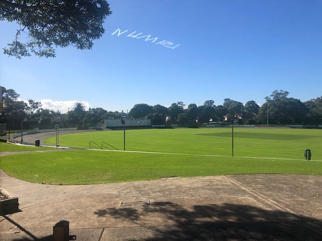
Hurstville Oval is a multi-use sporting ground, located in the suburb of Hurstville, in Sydney's southern suburbs. Since its opening, it has held various sports at the venue – including Cricket, Rugby League, Cycling and Football. The oval also has a velodrome in the grounds, between the field and the stands.
Hurstville Oval, Dora St
Hurstville Oval is a multi-use sporting ground, located in the suburb of Hurstville, in Sydney's southern suburbs. Since its opening, it has held various sports at the venue – including Cricket, Rugby League, Cycling and Football. The oval also has a velodrome in the grounds, between the field and the stands.
Museum
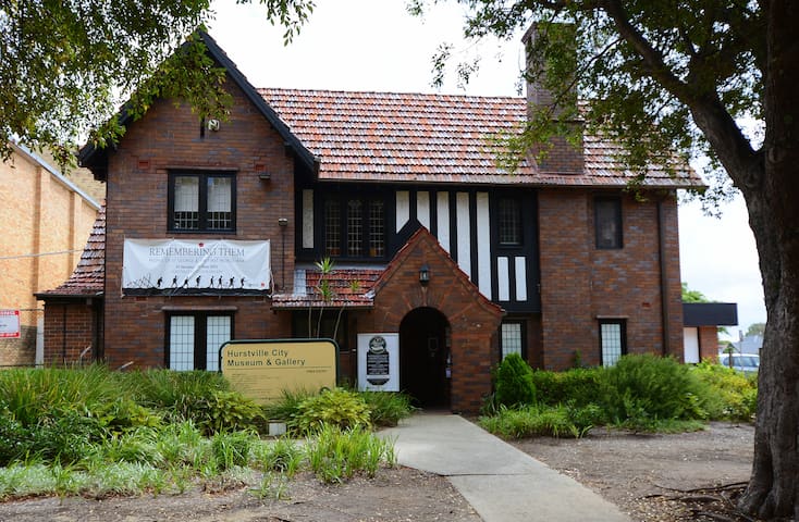
Hurstville Museum & Gallery opened in 2004 and is maintained by Georges River Council. Located on MacMahon Street, in the centre of the Hurstville CBD, it is the only regional museum and gallery in the St George district. A popular destination for thousands of local and interstate visitors each year, the Museum & Gallery is a vibrant hub of community activity, with regular talks, programs, special events, and dynamic exhibitions. The Museum & Gallery also offers a range of syllabus-linked educational programs for primary and secondary students. Hurstville Museum & Gallery is dedicated to preserving the unique history of the St George region, as well as working with local multicultural communities to develop exciting art and history exhibitions and public programs.
Hurstville Museum & Gallery
14 Macmahon StHurstville Museum & Gallery opened in 2004 and is maintained by Georges River Council. Located on MacMahon Street, in the centre of the Hurstville CBD, it is the only regional museum and gallery in the St George district. A popular destination for thousands of local and interstate visitors each year, the Museum & Gallery is a vibrant hub of community activity, with regular talks, programs, special events, and dynamic exhibitions. The Museum & Gallery also offers a range of syllabus-linked educational programs for primary and secondary students. Hurstville Museum & Gallery is dedicated to preserving the unique history of the St George region, as well as working with local multicultural communities to develop exciting art and history exhibitions and public programs.
Carss Cottage sits like a jewel on the highest point of Carss Bush Park surrounded by beautiful trees and overlooking Kogarah Bay. It has been recognised, together with the park to be protected as a place of beauty and a permanent conservation order was placed on the area in 1988.
The Museum is housed in the cottage which was built in 1865 from stone quarried on the property.
Wandering through the Museum you can see a model of the Cottage as it was in 1865; the parlour set for tea on a table made by William Carss. Discover the history of William Carss and his family.
Cocky Bennett, the bird who lived to 119 years is on display and for the romantics there is the wedding dress that was never worn.
Kogarah Historical Society is privileged to run the Museum which focuses on collecting items relating to Kogarah’s past and present history.
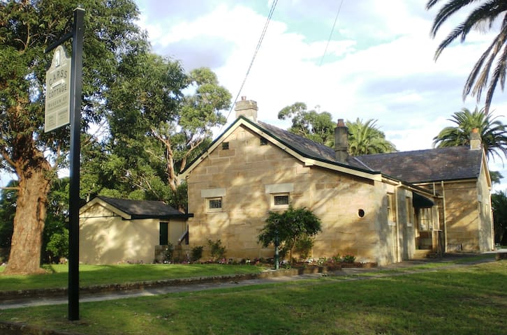
Carss Cottage Museum
80 Carwar AvenueCarss Cottage sits like a jewel on the highest point of Carss Bush Park surrounded by beautiful trees and overlooking Kogarah Bay. It has been recognised, together with the park to be protected as a place of beauty and a permanent conservation order was placed on the area in 1988.
The Museum is housed in the cottage which was built in 1865 from stone quarried on the property.
Wandering through the Museum you can see a model of the Cottage as it was in 1865; the parlour set for tea on a table made by William Carss. Discover the history of William Carss and his family.
Cocky Bennett, the bird who lived to 119 years is on display and for the romantics there is the wedding dress that was never worn.
Kogarah Historical Society is privileged to run the Museum which focuses on collecting items relating to Kogarah’s past and present history.
New South Wales-i Művészeti Galéria
Art Gallery Road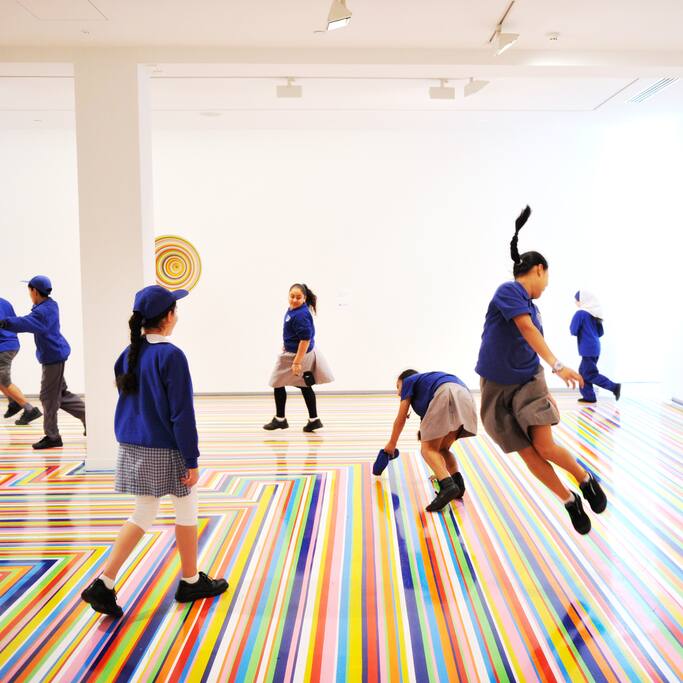
Kortárs Művészeti Múzeum
140 George St
Powerhouse Múzeum
500 Harris StAusztrál Nemzeti Tengerészeti Múzeum
2 Murray StNational Museum of Australian Pottery
Hyde Park laktanyái
Macquarie StreetSydney Obszervatórium
1003 Upper Fort StAusztrál Nemzeti Tengerészeti Múzeum
2 Murray StTransport
Beverly Hills railway station is a heritage-listed former railway bridge and now railway station located on the East Hills line, serving the Sydney suburb of Beverly Hills in the Georges River Council local government area of New South Wales, Australia. The station is served by Sydney Trains T8 Airport & South line services.
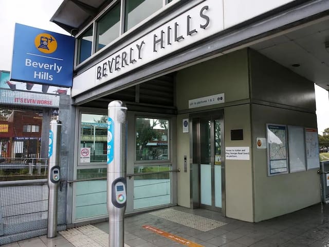
Beverly Hills Station
Beverly Hills railway station is a heritage-listed former railway bridge and now railway station located on the East Hills line, serving the Sydney suburb of Beverly Hills in the Georges River Council local government area of New South Wales, Australia. The station is served by Sydney Trains T8 Airport & South line services.
Hurstville railway station is located on the Illawarra line, serving the Sydney suburb of Hurstville. It is served by Sydney Trains T4 line services and NSW TrainLink South Coast line services.
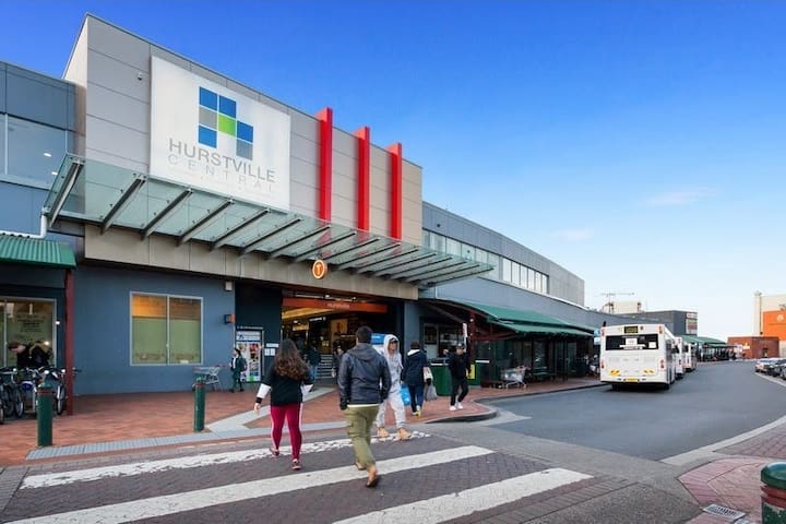
Hurstville Station, Forest Rd, Stand C
Hurstville railway station is located on the Illawarra line, serving the Sydney suburb of Hurstville. It is served by Sydney Trains T4 line services and NSW TrainLink South Coast line services.
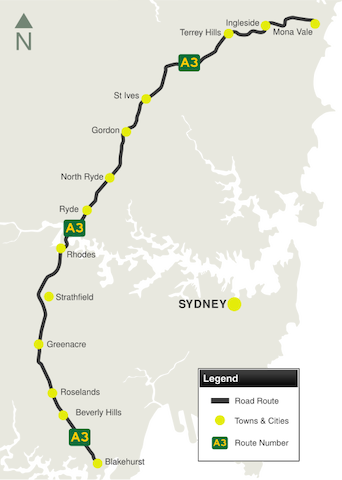
The name "A3" is the route allocation for the route as a whole, not a road name. The A3 route runs along a whole series of differently named roads. From north to south they are:
*Mona Vale Road
*Ryde Road
*Lane Cove Road
*Devlin Street
*Church Street
*Concord Road
*Homebush Bay Drive
*Centenary Drive
*Roberts Road
*Wiley Avenue
*King Georges Road
It is a major connector between most of the major radial routes emanating from central Sydney, and a major link between the northern and southern parts of the Sydney tolled orbital freeway. It is the most direct, although not necessarily the quickest, route across Sydney between the South Coast and the North Coast. It is one of only three road connections between the Northern Beaches region of Sydney and the rest of Sydney (the other two being the A38 (Warringah Road) and the A8.
*Length: 51 km
*Northern Terminus: Pittwater Rd (A8), Mona Vale
*Southern Terminus: Princes Hwy (A1) at Blakehurst
*Suburbs, Towns & Localities Along Route: Mona Vale, Ingleside, Terrey Hills, St Ives, Gordon, North Rye, Ryde, Rhodes, Strathfield, Greenacre, Roselands, Beverly Hills and Blakehurst
King Georges Road
King Georges RoadThe name "A3" is the route allocation for the route as a whole, not a road name. The A3 route runs along a whole series of differently named roads. From north to south they are:
*Mona Vale Road
*Ryde Road
*Lane Cove Road
*Devlin Street
*Church Street
*Concord Road
*Homebush Bay Drive
*Centenary Drive
*Roberts Road
*Wiley Avenue
*King Georges Road
It is a major connector between most of the major radial routes emanating from central Sydney, and a major link between the northern and southern parts of the Sydney tolled orbital freeway. It is the most direct, although not necessarily the quickest, route across Sydney between the South Coast and the North Coast. It is one of only three road connections between the Northern Beaches region of Sydney and the rest of Sydney (the other two being the A38 (Warringah Road) and the A8.
*Length: 51 km
*Northern Terminus: Pittwater Rd (A8), Mona Vale
*Southern Terminus: Princes Hwy (A1) at Blakehurst
*Suburbs, Towns & Localities Along Route: Mona Vale, Ingleside, Terrey Hills, St Ives, Gordon, North Rye, Ryde, Rhodes, Strathfield, Greenacre, Roselands, Beverly Hills and Blakehurst
Bankstown Airport
1B Avro StCockle Bay Wharf
201 Sussex StRiver
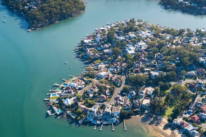
The Georges River, formerly known as Tucoerah River, is an intermediate tide dominated drowned valley estuary, located to the south and west of Sydney. The Georges River begins its journey approximately 60km south-west of Sydney in the town of Appin. From here the river flows north towards Liverpool, through the Chipping Norton Lakes Scheme, then east until it reaches Botany Bay. The catchment area of the remarkable Georges River covers an area of approximately 960km2 and, with over 1 million people living within it, is one of the most highly urbanised catchments in Australia.
The river has a number of important tributaries including Bunburry Curran Creek in Glenfield; Cabramatta Creek in Cabramatta; Prospect Creek in Georges Hall; Williams Creek in Holsworthy; Salt Pan Creek in Padstow; Mill Creek in Menai; and the Woronora River in Illawong.
The Georges River was an important focal point for Aboriginal life and culture in the southern Sydney region, offering both food, transport and dreamtime links. Several major language groups existed along the river: Eora to the east, Dharug to the west, north and north-east, Dharawal to the south and Gandangarra in the far south-west.
The river was first explored by Bass and Flinders in 1795 on their first voyage on the Tom Thumb after their arrival in New South Wales. The exploration led to the establishment of Bankstown. The early 1800's saw European settlers migrating to the areas along the Georges River and the river became increasingly important as a transport route. Much of the catchment was cleared for farmlands and housing, however the banks stayed relatively untamed due to their rugged slopes. Development within the catchment has only flourished since WWII. The consequences of urbanisation in the catchment are significant, with stormwater pollution, increased runoff and vegetation loss all of great concern.
Liverpool weir, constructed in 1836 by convict labour, forms the tidal limit for the river. It was built to supply water to the town of Liverpool and to serve as a causeway across the Georges River.
The Georges River National Park was established in 1992. It is located in the middle reaches of the River within the Bankstown and Sutherland Council areas and covers approximately 5.14km2. Prior to becoming a National Park, it was a state recreation area under the management of a trust.
The Georges River is a popular area for recreational fishing. Species present in the river include bass, bream, whiting, yellowtail, jewfish and flathead. The river is also host to a number of commercial oyster farms. The upper ends of the Georges River are abundant with Bass during the summer months and during the winter months, these bass migrate down to the lower ends of the river towards the salt water to breed.
Georges River, New South Wales, Ausztrália
The Georges River, formerly known as Tucoerah River, is an intermediate tide dominated drowned valley estuary, located to the south and west of Sydney. The Georges River begins its journey approximately 60km south-west of Sydney in the town of Appin. From here the river flows north towards Liverpool, through the Chipping Norton Lakes Scheme, then east until it reaches Botany Bay. The catchment area of the remarkable Georges River covers an area of approximately 960km2 and, with over 1 million people living within it, is one of the most highly urbanised catchments in Australia.
The river has a number of important tributaries including Bunburry Curran Creek in Glenfield; Cabramatta Creek in Cabramatta; Prospect Creek in Georges Hall; Williams Creek in Holsworthy; Salt Pan Creek in Padstow; Mill Creek in Menai; and the Woronora River in Illawong.
The Georges River was an important focal point for Aboriginal life and culture in the southern Sydney region, offering both food, transport and dreamtime links. Several major language groups existed along the river: Eora to the east, Dharug to the west, north and north-east, Dharawal to the south and Gandangarra in the far south-west.
The river was first explored by Bass and Flinders in 1795 on their first voyage on the Tom Thumb after their arrival in New South Wales. The exploration led to the establishment of Bankstown. The early 1800's saw European settlers migrating to the areas along the Georges River and the river became increasingly important as a transport route. Much of the catchment was cleared for farmlands and housing, however the banks stayed relatively untamed due to their rugged slopes. Development within the catchment has only flourished since WWII. The consequences of urbanisation in the catchment are significant, with stormwater pollution, increased runoff and vegetation loss all of great concern.
Liverpool weir, constructed in 1836 by convict labour, forms the tidal limit for the river. It was built to supply water to the town of Liverpool and to serve as a causeway across the Georges River.
The Georges River National Park was established in 1992. It is located in the middle reaches of the River within the Bankstown and Sutherland Council areas and covers approximately 5.14km2. Prior to becoming a National Park, it was a state recreation area under the management of a trust.
The Georges River is a popular area for recreational fishing. Species present in the river include bass, bream, whiting, yellowtail, jewfish and flathead. The river is also host to a number of commercial oyster farms. The upper ends of the Georges River are abundant with Bass during the summer months and during the winter months, these bass migrate down to the lower ends of the river towards the salt water to breed.
Beach
Brighton-Le-Sands Guide: Sydney’s Mediterranean!
With calm, clear water, soft white sand and a choice of international restaurants, Brighton-Le-Sands down in the south of Sydney is a fantastic spot for a day out or even a Sydney staycation!
Situated along Sydney’s longest beach (Lady Robinsons) on the shores of Botany Bay, Brighton has a Mediterranean feel, as well as a walk/cycle track running all the way up to Kyeemagh and down to Ramsgate if you’re feeling active.
Being close to Sydney Airport, it’s a great area to stay in if you need to catch a plane. And with its Greek and Italian restaurants, you’ll already feel like you’re on holiday! While Botany Bay does have some aircraft noise and industrial Port Botany in the distance, it still has a beautiful beach and a great atmosphere.
So if you’re looking for a change from the Eastern Suburbs, here’s my guide to visiting Brighton-Le-Sands.
Where is Brighton-Le-Sands?
Brighton-Le-Sands is about 13km southwest of Sydney CBD, on the long stretch of Botany Bay beaches to the west of Sydney Airport. It’s a great spot to take visitors to if they’ve got a few hours to kill before catching a plane.
*Route 479 runs from Rockdale Plaza via Rockdale railway station to Kyeemagh and Brighton Le Sands.
*Route 947 runs from Hurstville Station to Ramsgate and Dolls Point.
Brighton-Le-Sands Restaurants
Brighton is sometimes referred to as “Little Greece”, and you’ll see why if you go for a stroll along Bay Street. For waterside dining, try Le Sands Restaurant at the pavilion, which serves lunch and dinner seven days a week.
Here’s a list of some of the other popular restaurants in Brighton-Le-Sands:
Meet the Greek
Café Neptune
Bondi Pizza
Abode Thai
Bianco Kitchen – Italian
Hurricane Grill – Steak and ribs
Atlantis on the Bay – Lebanese
La Piazza – Wood-fired pizzeria
33 helybéli ajánlásával
Brighton-Le-Sands Beach
The Grand ParadeBrighton-Le-Sands Guide: Sydney’s Mediterranean!
With calm, clear water, soft white sand and a choice of international restaurants, Brighton-Le-Sands down in the south of Sydney is a fantastic spot for a day out or even a Sydney staycation!
Situated along Sydney’s longest beach (Lady Robinsons) on the shores of Botany Bay, Brighton has a Mediterranean feel, as well as a walk/cycle track running all the way up to Kyeemagh and down to Ramsgate if you’re feeling active.
Being close to Sydney Airport, it’s a great area to stay in if you need to catch a plane. And with its Greek and Italian restaurants, you’ll already feel like you’re on holiday! While Botany Bay does have some aircraft noise and industrial Port Botany in the distance, it still has a beautiful beach and a great atmosphere.
So if you’re looking for a change from the Eastern Suburbs, here’s my guide to visiting Brighton-Le-Sands.
Where is Brighton-Le-Sands?
Brighton-Le-Sands is about 13km southwest of Sydney CBD, on the long stretch of Botany Bay beaches to the west of Sydney Airport. It’s a great spot to take visitors to if they’ve got a few hours to kill before catching a plane.
*Route 479 runs from Rockdale Plaza via Rockdale railway station to Kyeemagh and Brighton Le Sands.
*Route 947 runs from Hurstville Station to Ramsgate and Dolls Point.
Brighton-Le-Sands Restaurants
Brighton is sometimes referred to as “Little Greece”, and you’ll see why if you go for a stroll along Bay Street. For waterside dining, try Le Sands Restaurant at the pavilion, which serves lunch and dinner seven days a week.
Here’s a list of some of the other popular restaurants in Brighton-Le-Sands:
Meet the Greek
Café Neptune
Bondi Pizza
Abode Thai
Bianco Kitchen – Italian
Hurricane Grill – Steak and ribs
Atlantis on the Bay – Lebanese
La Piazza – Wood-fired pizzeria